Uncontrolled Field Tour II
As part of tuning up to go east this Christmas, I went out Sunday and did one of my favorite training exercises: an uncontrolled field tour. An uncontrolled filed is one with no tower to direct traffic, and often no weather information available beyond a windsock at the field (though others have full automated weather broadcast continuously). While an uncontrolled field is usually less busy than a towered one, they do force the pilot to pay more attention to the world outside the window, knowing that no tower controller will provide another pair of eyes. Air Traffic Control is also not going to provide traffic advisories or the like in the pattern at an uncontrolled field. The runways are often shorter and narrower, too.
I did my first tour several years ago when I was feeling uncomfortable about my uncontrolled field radio and pattern entry work, and I reprised it last weekend just to polish that corner of my skill set. Basically, I go up into the central valley and hop between 8 fields. Once I’m in the valley, I don’t get flight following, and stay down around 2500′ feet between airports. I operate primarily by pilotage, and drill those skills as well as pattern entries and uncontrolled radios.
It was a lot easier this time than last. I think my approach and landing skills have gotten a lot better. I was much more comfortable getting on and off even the shorter fields in the mix this time. Here’s a quick recap.
The first field I wanted to hit was a new one for me: Bakersfield Municipal, near the south edge of Bakersfield. I flew through the Gorman pass and went through some strong up and down drafts. I lost a couple hundred feet of altitude on more than one occasion by encountering a downdraft that I couldn’t out climb. I reported them to ATC, but all they can do is warn people. Once in the Central Valley, the winds eased off, and operations were straightforward.
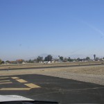
I didn’t stop long at most of the fields, but I did take a picture or two at most. I took most of them from the cockpit with the plane stopped and the engine running, so the quality isn’t great. That’s a V-tail Bonanza landing at Bakersfield after I got there. He was headed for the airport restaurant. I haven’t been there, but I’ll be back. The field looks clean and well kept up.
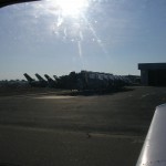
From Bakersfield it was up to Shafter-Minter airport, which I found by following some railroad tracks. The other times I’ve been to Shafter I’ve seen biplanes in the pattern, including a couple low passes; no such luck today. You can see some interesting aircraft on the ramp in the picture, though.
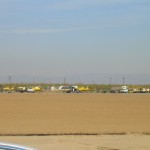
From Shafter, more railroad tracks brought me over to Wasco Airport. This is a little field used primarily by crop dusters, it looks like. I was pleasantly surprised to hear someone come into the field as I was leaving the area. It sounded like a student on a cross country. Here are a few planes on the ramp at Wasco:
From Wasco, it was a short hop over to Delano Municipal, which had a long runway, continuous weather reporting, and a restaurant and helicopter repair shop on the field. No one was around over there, though, so I made a landing, snapped a shot of a bunch of helicopter fuselages at the repair shop and set out again.
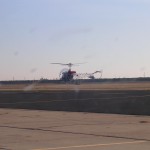
The next stop, Porterville, is a favorite airport. It’s somewhat out of the way, but the food at the restaurant is good, though it has changed hands a couple times. I planned a stop here for food and gas, but was disappointed. The restaurant was closed, though I did fuel up, and watch an old Bell helicopter taking some landing practice.
From Porterville, I started across the valley to Corcoran, a small field used primarily for crop dusting. It was narrower than most of the fields I hit that day, and very utilitarian. I always feel like I’m intruding on someone’s workplace when they’ve just stepped out when I come in and out of there, so I didn’t stay long. As I turned around to leave, I snapped this shot of the AgTractors at rest.
The next field on my list was the unattended strip at Lost Hills. There’s remarkably little at Lost hills, except for a runway and a few tie downs. I think this is primarily used to bring equipment in and out of the oil drilling sites in the region. It was easy enough to find from Corcoran by following the 5. Here’s the windsock (and segmented circle). As you can see, the sun’s going down, and I really like this picture. I like how the windsock marks this a point of civilization but feels far from home.
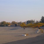
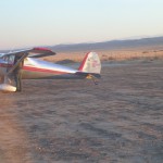
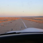
From here, my last stop was Buttonwillow airport, another unattended strip just down the canal from Lost Hills. I like Buttonwillow much more than I should, partially because I’ve had some cool experiences there. Today as I was approaching from the north, I heard another aircraft approaching to land, which always surprises me; I always think I’m the only one who knows about Buttonwillow. It turned out to be a Luscombe, who was straight in. I let him in ahead of me and took a shot of the setting sun, the Luscombe (the nose is cut off in the thumbnail, but not the full shot), and the runway, which is really getting overgrown a bit. I really like the runway shot because it again captures the out-of-the way feel of the place. Try to ignore all the bugs on the windshield.
From here it was back to SMO in the fading light for a night landing that didn’t count toward currency. I imagine that this wouldn’t be much fun for most passengers, but I enjoyed a day of picking my way along at a low altitude, getting into and out of small fields and generally just flying.
